Affordable. Reliable. CAD.
A desktop survey and design program created for surveyors, contractors and engineers.
Solutions
Save Your Office Time
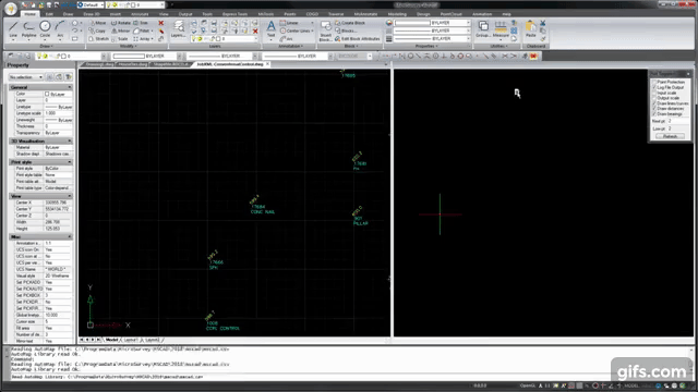
Land Surveying is a competitive industry and we understand that finding ways to help you save time in the office makes a big difference to the bottom line. MicroSurvey CAD’s “Field to Finish” process makes creation of a drawing directly from fieldwork quick and painless. Whether you use total stations, GNSS, scanners or photogrammetry, we can help you turn that data into a deliverable. You can import linework directly from Leica Captivate and FieldGenius equipped controllers or use a variety of point coding systems. Our AutoMap field coding system allows you to automate creation of layers, colours, linetypes, custom blocks and supports custom field inputs. If corrections to fieldwork need to be made the process is enormously simplified as all line and point attributes assigned are “smart” and will be updated as soon as you adjust your points.
Features Used
3D Rendering
COGO Calculations
Solutions
Efficient Topo
I am here to share a few simple yet creative ways, to advertise your new home business. A few suggestions would be, newspapers is the one source that many people go to, and money where you can be spending it on something else. See the how these features below can save you time in creating large subdivisions I am here to share a few simple yet creative ways, to advertise your new home business. A few suggestions would be, newspapers is the one source that many people go to.
Features Used
3D Rendering
COGO Calculations
Solutions
Efficent Topo
Land Surveying is a competitive industry and we understand that finding ways to help you save time in the office makes a big difference to the bottom line. MicroSurvey CAD’s “Field to Finish” process makes creation of a drawing directly from fieldwork quick and painless. Whether you use total stations, GNSS, scanners or photogrammetry, we can help you turn that data into a deliverable. You can import linework directly from Leica Captivate and FieldGenius equipped controllers or use a variety of point coding systems. Our AutoMap field coding system allows you to automate creation of layers, colours, linetypes, custom blocks and supports custom field inputs. If corrections to fieldwork need to be made the process is enormously simplified as all line and point attributes assigned are “smart” and will be updated as soon as you adjust your points.
Features Used
3D Rendering
COGO Calculations
FEATURE INDEX
The Features You Need…
GOOD DESIGN
Vestibulum et risus at sit mi ultra est sagittis quis est nec ligula. Lorem ipsum amet.
MODERN TEMPLATES
Vestibulum et risus at sit mi ultra est sagittis quis est nec ligula. Lorem ipsum amet.
FREE GOOGLE FONTS
Vestibulum et risus at sit mi ultra est sagittis quis est nec ligula. Lorem ipsum amet.
STYLE EDITOR
Vestibulum et risus at sit mi ultra est sagittis quis est nec ligula. Lorem ipsum amet.
HUGE COMPONENTS
Vestibulum et risus at mi ultra est sagittis quis nec ligula.
24/7 CUSTOMER SERVICE
Vestibulum et risus at sit mi ultra est sagittis quis est nec ligula. Lorem ipsum amet.
FULLY RESPONSIVE
Vestibulum et risus at sit mi ultra est sagittis quis est nec ligula. Lorem ipsum amet.
CUSTOM CSS
Vestibulum et risus at sit mi ultra est sagittis quis est nec ligula. Lorem ipsum amet.
BUILT-IN MOBILE WEBSITE
Vestibulum et risus at sit mi ultra est sagittis quis est nec ligula. Lorem ipsum amet.
CONTENT LAYOUTS
Vestibulum et risus at sit mi ultra est sagittis quis est nec ligula. Lorem ipsum amet.
GALLERY BLOCKS
Vestibulum et risus at sit mi ultra est sagittis quis est nec ligula. Lorem ipsum amet.
EASY IMPORTING
Vestibulum et risus at sit mi ultra est sagittis quis est nec ligula. Lorem ipsum amet.
Note – Yes, I’m a dummy text. Anyway I look nice and useful in some ways. I’m knowledgeable. Lorem ipsum sit amet, vestibulum et risus at sit mi ultra est sagittis quis est nece ligula is my favourite idea. But I also like to live dangerously. Promised.
UPDATES
What's New?
Lorem ipsum dolor sit amet, vix an natum labitur eleifend, mel ad amet laoreet menandri. Ei justo complectitur duo.
Ei mundi solet sit, ut solet possit quo. Sea cu justo laudem.


TESTIMONIALS
What Our Customers Are Saying

Want to try it out?

Quick Links
[wbcr_php_snippet id="221056"]
About Us
About Us
© 2019 MicroSurvey Software Inc. All rights reserved