News
Data Organization and Faster Processing: inCAD & embeddedCAD 2026.1
Data Organization and Faster Processing: inCAD & embeddedCAD 2026.1The MicroSurvey embeddedCAD and inCAD 2026.1 Service Pack is officially live and ready for download.For this update, we focused heavily...

Data Organization and Faster Processing: inCAD & embeddedCAD 2026.1
Data Organization and Faster Processing: inCAD & embeddedCAD 2026.1The MicroSurvey embeddedCAD and inCAD 2026.1 Service Pack is officially live and ready for download.For this update, we focused heavily...
Data Organization and Faster Processing: inCAD & embeddedCAD 2026.1
For this update, we focused heavily on giving you better ways to organize your workspace and speeding up the core calculations you rely on every day. Whether you draft using the embedded AutoCAD® engine or run inCAD on your existing setup, this service pack brings highly requested features directly to your fingertips so you can spend less time managing files and more time finishing projects.
FieldGenius 3.3 Released: Speed, Automation, and Reliability
FieldGenius 3.3 Released: Speed, Automation, and ReliabilityWe’ve overhauled the core workflows to ensure your field-to-office transitions are faster and more intuitive than ever. From faster instrument connections to streamlined data management, FieldGenius 3.3 is...
FieldGenius 3.3 Released: Speed, Automation, and Reliability
We’ve taken the industry’s most trusted adjustment engine and optimized it for the modern professional. From high-speed rendering to virtual server automation, STAR*NET 14 is ready for any environment you throw at it.
Streamlining Setup, Exports, and Support: Inside FieldGenius 3.3
Streamlining Setup, Exports, and SupportEfficiency is at the heart of your workday, and with the upcoming launch of FieldGenius 3.3, we’re ensuring your field-to-office transitions are more intuitive than ever. [wp-video-popup id="video1"...
Streamlining Setup, Exports, and Support: Inside FieldGenius 3.3
Efficiency is at the heart of your workday, and with the upcoming launch of FieldGenius 3.3, we’re ensuring your field-to-office transitions are more intuitive than ever.
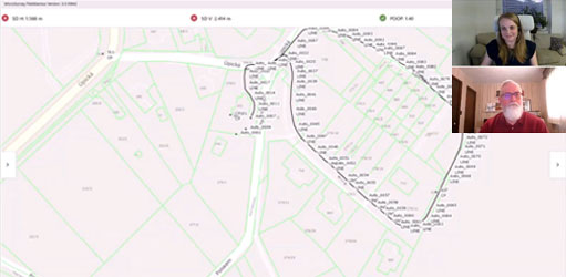
Now Live: The FieldGenius Academy Online Training
FieldGenius Academy Online Training is Now LiveA surveyor’s job isn't done until the data is usable. Join James Johnston, Support and Training Manager, as he guides you through Network Rover GNSS Topographic surveying, mastering the FieldGenius workflows that ensure a...
STAR*NET 14 is Here: Performance, Versatility, and Automation.
STAR*NET 14: Performance, Versatility, and AutomationWe’ve taken the industry’s most trusted adjustment engine and optimized it for the modern professional. From high-speed rendering to virtual server automation, STAR*NET 14 is ready for any environment you throw at...