CUSTOMER STORIES > SUMMIT LAND SURVEYINGAchieving Peak Performance with MicroSurveyWith MicroSurvey CAD and STAR*NET, Summit Land Surveying has built a streamlined workflow that delivers accuracy, efficiency, and confidence on every project.Meet Summit Land...
MicroSurvey CAD
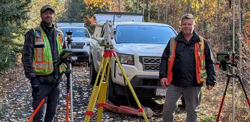
Achieving Peak Performance with MicroSurvey
CUSTOMER STORIES > SUMMIT LAND SURVEYINGAchieving Peak Performance with MicroSurveyWith MicroSurvey CAD and STAR*NET, Summit Land Surveying has built a streamlined workflow that delivers accuracy, efficiency, and confidence on every project.Meet Summit Land...
Achieving Peak Performance with MicroSurvey
Reach RS2 is a handy companion for land surveyors around the world, as it can be easily implemented into existing workflows. Reach RS2 works smoothly with various field software including MicroSurvey’s FieldGenius for Android. Check out how Jon Campbell from Ohio applied Reach RS2 and FieldGenius for Android in his daily business.
MicroSurvey CAD 2026: Advanced Data Management and Expanded Compatibility
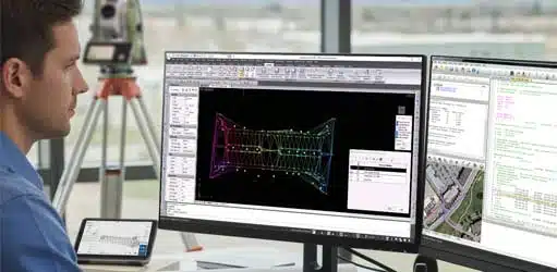
Advanced Data Management and Expanded CompatibilityMicroSurvey CAD 2026 is engineered to handle the increasing complexity of modern survey data. This version moves beyond simple drafting upgrades to deliver powerful new data management tools and direct point cloud...
MicroSurvey CAD 2026: Advanced Data Management and Expanded Compatibility
MicroSurvey CAD 2026 is engineered to handle the increasing complexity of modern survey data. This version moves beyond simple drafting upgrades to deliver powerful new data management tools and direct point cloud compatibility. For your firm, this means streamlined workflows for surface modeling, reduced reliance on complex CAD layering, and the ability to bid on projects requiring diverse point cloud formats.
Stop Costly Survey Errors Before They Happen
Stop Costly Survey Errors Before They HappenAre you looking for ways to streamline your MicroSurvey CAD workflow and save valuable time on every project? Discover the Lot Closure routine, a powerful feature designed to transform your drafting process.[wp-video-popup...
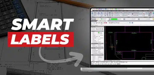
Enhance Your Drafting with MicroSurvey CAD Smart Labels!
Stop Manual Labeling! Smart Labels in MicroSurvey CAD Explained Are you looking for ways to streamline your MicroSurvey CAD workflow and save valuable time on every project? Discover Smart Labels, a powerful feature...
Enhance Your Drafting with MicroSurvey CAD Smart Labels!
Stop Manual Labeling! Smart Labels in MicroSurvey CAD Explained Are you looking for ways to streamline your MicroSurvey CAD workflow and save valuable time on every project? Discover Smart Labels, a powerful feature...
Enhance Your Drafting with MicroSurvey CAD Smart Labels!
Stop Manual Labeling! Smart Labels in MicroSurvey CAD Explained Are you looking for ways to streamline your MicroSurvey CAD workflow and save valuable time on every project? Discover Smart Labels, a powerful feature...