STAR*NET 14: Performance, Versatility, and AutomationWe’ve taken the industry’s most trusted adjustment engine and optimized it for the modern professional. From high-speed rendering to virtual server automation, STAR*NET 14 is ready for any environment you throw at...
STAR*NET

STAR*NET 14 is Here: Performance, Versatility, and Automation.
STAR*NET 14: Performance, Versatility, and AutomationWe’ve taken the industry’s most trusted adjustment engine and optimized it for the modern professional. From high-speed rendering to virtual server automation, STAR*NET 14 is ready for any environment you throw at...
STAR*NET 14 is Here: Performance, Versatility, and Automation.
We’ve taken the industry’s most trusted adjustment engine and optimized it for the modern professional. From high-speed rendering to virtual server automation, STAR*NET 14 is ready for any environment you throw at it.
Precision meets automation with the new Auto-Adjust Command Line
Automate your troubleshooting with STAR*NET 14Precision is the heart of what you do, and with the upcoming launch of STAR*NET 14, we’re ensuring that your most complex workflows are as streamlined and hands-free as possible.[wp-video-popup id="video1"...
Precision meets automation with the new Auto-Adjust Command Line
Precision is the heart of what you do, and with the upcoming launch of STAR*NET 14, we’re ensuring that your most complex workflows are as streamlined and hands-free as possible.
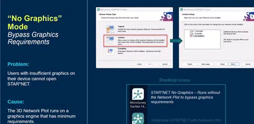
Eliminating hardware barriers with No Graphics Mode in STAR*NET 14
Eliminating hardware barriers with No Graphics Mode.You need results wherever the job takes you. STAR*NET 14 is evolving to run flawlessly across more environments, ensuring your workflow remains uninterrupted by hardware limitations or virtual server...
Eliminating hardware barriers with No Graphics Mode in STAR*NET 14
You need results wherever the job takes you. STAR*NET 14 is evolving to run flawlessly across more environments, ensuring your workflow remains uninterrupted by hardware limitations or virtual server constraints.
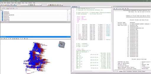
Elevating Your Visualization in STAR*NET 14
See how we’ve optimized the Network Plot for massive datasets.Precision is the heart of what you do, and with the upcoming launch of STAR*NET 14, we’re ensuring that the software's visualization finally matches its world-class math. [wp-video-popup id="video1"...
Elevating Your Visualization in STAR*NET 14
Precision is the heart of what you do, and with the upcoming launch of STAR*NET 14, we’re ensuring that the software’s visualization finally matches its world-class math.