FieldGenius Academy Online Training is Now LiveA surveyor’s job isn't done until the data is usable. Join James Johnston, Support and Training Manager, as he guides you through Network Rover GNSS Topographic surveying, mastering the FieldGenius workflows that ensure a...
Update

Now Live: The FieldGenius Academy Online Training
FieldGenius Academy Online Training is Now LiveA surveyor’s job isn't done until the data is usable. Join James Johnston, Support and Training Manager, as he guides you through Network Rover GNSS Topographic surveying, mastering the FieldGenius workflows that ensure a...
Now Live: The FieldGenius Academy Online Training
A surveyor’s job isn’t done until the data is usable. Join James Johnston, Support and Training Manager, as he guides you through Network Rover GNSS Topographic surveying, mastering the FieldGenius workflows that ensure a perfect import into your CAD software.
STAR*NET 14 is Here: Performance, Versatility, and Automation.
STAR*NET 14: Performance, Versatility, and AutomationWe’ve taken the industry’s most trusted adjustment engine and optimized it for the modern professional. From high-speed rendering to virtual server automation, STAR*NET 14 is ready for any environment you throw at...
STAR*NET 14 is Here: Performance, Versatility, and Automation.
We’ve taken the industry’s most trusted adjustment engine and optimized it for the modern professional. From high-speed rendering to virtual server automation, STAR*NET 14 is ready for any environment you throw at it.
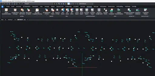
Now Available: SurveyTools for BricsCAD v26
See how we’ve achieved a 90% performance boost.Efficiency starts with alignment, and with the official launch of SurveyTools® for BricsCAD® v26, we’re ensuring your specialized survey toolset is perfectly synced with the latest platform innovations from...
Now Available: SurveyTools for BricsCAD v26
Efficiency starts with alignment, and with the official launch of SurveyTools® for BricsCAD® v26, we’re ensuring your specialized survey toolset is perfectly synced with the latest platform innovations from Bricsys
Precision meets automation with the new Auto-Adjust Command Line
Automate your troubleshooting with STAR*NET 14Precision is the heart of what you do, and with the upcoming launch of STAR*NET 14, we’re ensuring that your most complex workflows are as streamlined and hands-free as possible.[wp-video-popup id="video1"...
Precision meets automation with the new Auto-Adjust Command Line
Precision is the heart of what you do, and with the upcoming launch of STAR*NET 14, we’re ensuring that your most complex workflows are as streamlined and hands-free as possible.