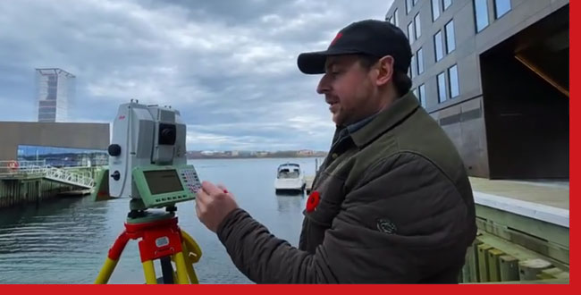
Scanning with the Leica MS60 Multistation at the Halifax Waterfront
Join us for today’s video where we head out in the field to do some scans with the new second generation Leica MS60 MultiStation. You’ll get to see a few of the scan options available to choose from when the MultiStation is tasked with scanning a scene at the Halifax waterfront in Nova Scotia, Canada.
Once the scans are finished, we take the dataset back to the office and show viewers some noteworthy tools available when using the Point Cloud features in MicroSurvey CAD Ultimate.
- One-Step Point-Cloud Import: MicroSurvey CAD can import a Leica DBX file containing scan data with an easy-to use, one-step utility. No complicated conversion processes or extra costly software packages required.
- The Clipping Manager: MicroSurvey CAD’s handy, straightforward to use tool for clipping out extraneous data from your Point Cloud. The Clipping Manager makes selecting complex areas to clip from your dataset particularly easy.
- The “Wall” Tool: MicroSurvey CAD has several orientation tools that allow users to control the work plane and simplify 3D drafting tasks, including the “Wall” tool which calculates the drafting plane based on a sampling of points.
MicroSurvey CAD has all the tools you need to perform feature extraction and three-dimensional drafting directly in your CAD program. Being able to incorporate scanning data into your existing MicroSurvey CAD drafting design process adds detail, accuracy, and value – improving the overall quality of your client deliverables.

