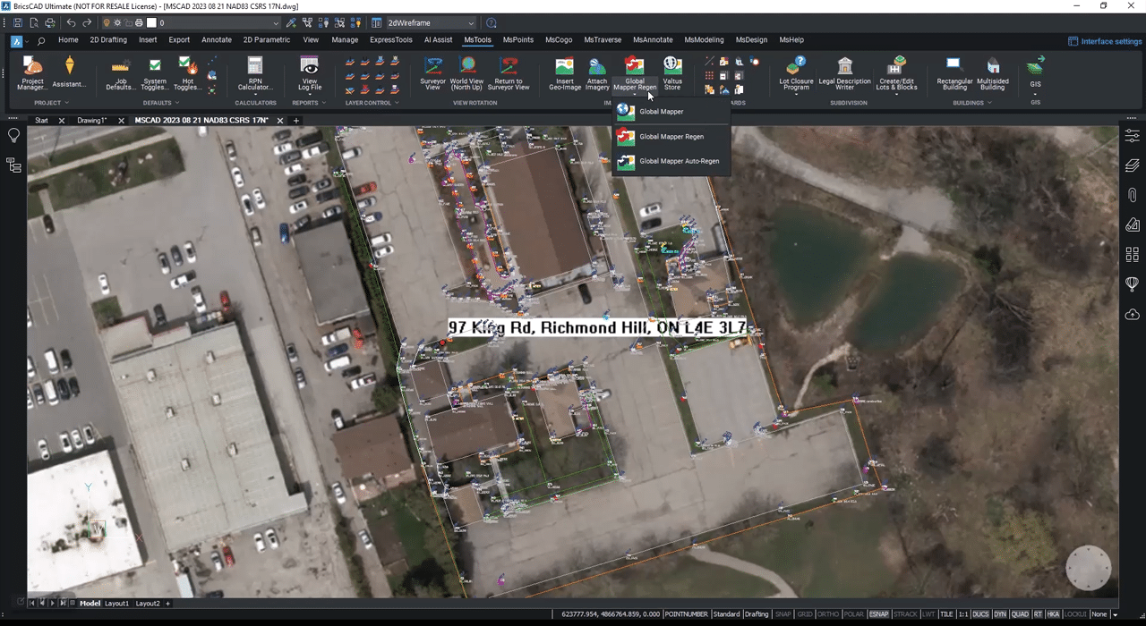
Making Informed Decisions With Powerful Imagery
SurveyTools™ for BricsCAD® version 24.1 focuses on empowering you with the context and clarity you need to make the best decisions for your projects. Now you can seamlessly stream imagery directly into your drawings using Web Map Services, providing instant access to real-world context and helping you understand your survey data in relation to its surroundings. Including this georeferenced imagery in your deliverables adds a whole new dimension of understanding for clients, stakeholders, and colleagues.

Whether you’re tracking construction progress, verifying site conditions, or planning future work, having this rich visual context at your fingertips empowers you to make smarter decisions more efficiently. We’ve also made significant behind-the-scenes improvements to ensure SurveyTools™ for BricsCAD® is more stable and reliable.
Test drive the latest release today with a fully functional 30-day demo and check out the incredible clarity that the Global Mapper can add to your surveying projects. If you would like more information on SurveyTools™ for BricsCAD® please visit the SurveyTools™ for BricsCAD® webpage.
