Pix4Dmapper
[et_pb_video_lightbox src=”https://www.youtube.com/watch?v=cOLuzRwWOaI” image_src=”//i.ytimg.com/vi/cOLuzRwWOaI/hqdefault.jpg” hide_overlayplay_button=”on” lightbox=”on” hide_video=”off” autoplay=”on” loop=”off” video_width=”50″ videolightbox_closeredirect_target=”off” pop_onload=”off” pop_onexit=”off” _builder_version=”3.17.2″ custom_css_main_element=”margin-top: -30% !important;”][/et_pb_video_lightbox]
Software for Professional Drone-based Mapping
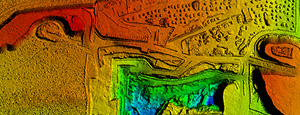
3D Point Cloud
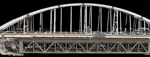 Laser scanner quality 3D points from a consumer-grade camera. Clean from moving objects, aerial perspective with limited occlusions, and low acquisition time.
Volume Calculation
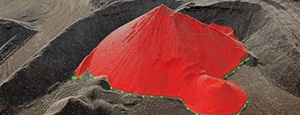 Output calculated volumes on a perfect representation of your stockpile, with adjustable base height and detailed view for more precise measurements.
Orthomosaic
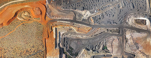 High resolution aerial map with corrected perspective, putting you in control of geographic data generation.
Contour Lines
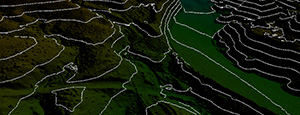 Generate contour lines for a simplified representation of topography, then export them for further work.
Digital Surface & Terrain Model
 Accurate, georeference elavation map, ready for your preferred GIS workflow.
Thermal Map
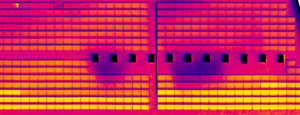 A radiometric accurate map displaying the temperature value of each pixel.
3D Textured Model
 Full 3D triangular mesh with photorealistic texturing, perfect for sharing and online visualization.
Taken by drone, by hand, or by plane and delivers highly precise, georeferenced 2D maps and 3D models. They’re customizable, timely, and complement a wide range of applications and software.
| Desktop Processing | Unlimited (desktop+laptop) |
| Cloud Processing | Unlimited* |
| Flight Planning | Pix4Dcapture |
| Flythrough videos | |
| Orthomosaic | |
| Digital surface model (DSM) | |
| Digital terrain model (DTM) | |
| 3D point cloud | |
| 3D textured model | |
| 2D measurements | |
| 2D vectorization output | |
| Volume measurements | |
| Index maps (NDVI, etc.) | |
| Web sharing | |
| * based on fair usage, 15 projects/month of 150 images @ 15 MP. Conditions may change at any time. |

Quick Links
[wbcr_php_snippet id=”221056″]
About Us
Enter To Receive emails
© 2019 MicroSurvey Software Inc. All rights reserved