Updates
Precise Volumes, Faster Decisions: Introducing In-Field Calculations
Precise Volumes, Faster Decisions: Introducing In-Field Calculations MicroSurvey proudly introduces FieldGenius 3, a landmark release and our first multiplatform software, unifying field data collection into a...

Precise Volumes, Faster Decisions: Introducing In-Field Calculations
Precise Volumes, Faster Decisions: Introducing In-Field Calculations MicroSurvey proudly introduces FieldGenius 3, a landmark release and our first multiplatform software, unifying field data collection into a...
Precise Volumes, Faster Decisions: Introducing In-Field Calculations
Precise Volumes, Faster Decisions: Introducing In-Field Calculations MicroSurvey proudly introduces FieldGenius 3, a landmark release and our first multiplatform software, unifying field data collection into a...
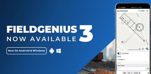
Unifying Data Collection Across Windows and Android
Unifying Data Collection Across Windows & Android MicroSurvey proudly introduces FieldGenius 3, a landmark release and our first multiplatform software, unifying field data collection into a single, powerful...
Unifying Data Collection Across Windows and Android
Unifying Data Collection Across Windows & Android MicroSurvey proudly introduces FieldGenius 3, a landmark release and our first multiplatform software, unifying field data collection into a single, powerful...
Unifying Data Collection Across Windows and Android
Unifying Data Collection Across Windows & Android MicroSurvey proudly introduces FieldGenius 3, a landmark release and our first multiplatform software, unifying field data collection into a single, powerful...
Ohio Surveyors Embrace Innovative Tools
Customer InterviewJon Campbell Campbell and AssociatesJon Campbell’s family has worked in the survey industry for almost 50 years. His grandfather started the business in 1979. Today, Campbell & Associates is a full-service land surveying firm with over 50...

Ohio Surveyors Embrace Innovative Tools
Customer InterviewJon Campbell Campbell and AssociatesJon Campbell’s family has worked in the survey industry for almost 50 years. His grandfather started the business in 1979. Today, Campbell & Associates is a full-service land surveying firm with over 50...
Ohio Surveyors Embrace Innovative Tools
Customer InterviewJon Campbell Campbell and AssociatesJon Campbell’s family has worked in the survey industry for almost 50 years. His grandfather started the business in 1979. Today, Campbell & Associates is a full-service land surveying firm with over 50...
FieldGenius for Android 2.6 Now Available
MicroSurvey's FieldGenius for Android™ has received a recent update, bringing it to version 2.6. This release introduces key fixes to improve software functionality and widens the range of supported hardware, ensuring surveyors have more flexibility with their...
What’s New in FieldGenius for Android 2.5?
MicroSurvey Software Inc. would like to inform you about the release of FieldGenius for Android™, version 2.5. With this iteration we focused primarily on workflow and stability improvements, as well as enhancement of the overall performance and reliability of...
What’s New in FieldGenius for Android 2.4?
Streamlined and Enhanced User Experience This service pack focuses on enhancing existing functions to elevate your user experience and boost efficiency. We are also introducing new features such as a GeoTiff image...

What’s New in FieldGenius for Android 2.4?
Streamlined and Enhanced User Experience This service pack focuses on enhancing existing functions to elevate your user experience and boost efficiency. We are also introducing new features such as a GeoTiff image...
What’s New in FieldGenius for Android 2.4?
Streamlined and Enhanced User Experience This service pack focuses on enhancing existing functions to elevate your user experience and boost efficiency. We are also introducing new features such as a GeoTiff image...