Updates
Preparing the Next Generation of Engineers
Preparing the Next Generation of Engineers with MicroSurveyWith MicroSurvey CAD and FieldGenius, New Brunswick Community College (NBCC) has modernized its Engineering Technology curriculum, providing students with industry-standard tools and the confidence needed to...
FieldGenius 3.3 Released: Speed, Automation, and Reliability
FieldGenius 3.3 Released: Speed, Automation, and ReliabilityWe’ve overhauled the core workflows to ensure your field-to-office transitions are faster and more intuitive than ever. From faster instrument connections to streamlined data management, FieldGenius 3.3 is...
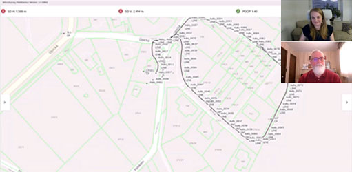
Streamlining Setup, Exports, and Support: Inside FieldGenius 3.3
Streamlining Setup, Exports, and SupportEfficiency is at the heart of your workday, and with the upcoming launch of FieldGenius 3.3, we’re ensuring your field-to-office transitions are more intuitive than ever. [wp-video-popup id="video1"...
Now Live: The FieldGenius Academy Online Training
FieldGenius Academy Online Training is Now LiveA surveyor’s job isn't done until the data is usable. Join James Johnston, Support and Training Manager, as he guides you through Network Rover GNSS Topographic surveying, mastering the FieldGenius workflows that ensure a...
FieldGenius 3.2: More Precision, Efficiency and Control
More Precision, Efficiency And ControlFieldGenius 3.2 enhances total station functionality with versatile new measurement modes and delivers critical GNSS driver updates. For your firm, this means reduced downtime in the field, stronger data manipulation tools, and...
FieldGenius 3.1: Connect More. Setup Faster. Manage Smarter.
FieldGenius 3.1: Now Fully Compatible with Leica & GeoMax Robotic Total Stations Building on the unified Windows and Android experience you rely on, FieldGenius 3.1 brings key enhancements that directly improve your daily fieldwork. This update adds Leica and GeoMax...